87-001/HMC18
·
Item
·
1688
Part of Robert Lloyd Hunter collection
Maps and atlases
485 Archival description results for Maps and atlases
465 results directly related
Exclude narrower terms
87-001/HMC14
·
Item
·
1747
Part of Robert Lloyd Hunter collection
87-001/MC12(01)
·
Item
·
1719
Part of Robert Lloyd Hunter collection
Chatelain's map of North America was published to promote the interests of the Compagnie Francoise Occident, a trading company established to encourage the development of the Louisiana territory and as a consequence of its development, the stabilization of a lagging French economy. The map illustrates the relationship among the French, English and Spanish claims on the continent.
87-001/MC11(01)
·
Item
·
1705
Part of Robert Lloyd Hunter collection
87-001/HMC19
·
Item
·
[1740?]
Part of Robert Lloyd Hunter collection
MFMC(07)
·
Item
·
1978
Part of Miscellaneous folded map collection
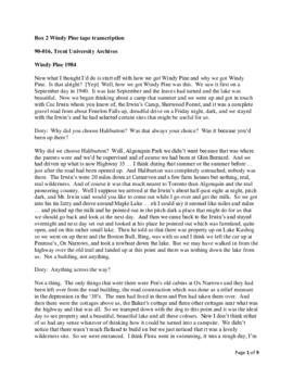
90-016
·
Fonds
·
1882-1989
This addition to the fonds consists of personal and career-related materials of Mary L. Northway such as cassettes with interviews, family wills, photographs and slides, an honorary doctorate from Trent University, correspondence and documents regarding the transfer of deed of Windy Pine property to Trent University, materials relating to camping and to Nominigan as well as copies of Mary Northway's publications. There are also business-related photographs, correspondence, etc. of John Northway, Mary Northway's grandfather. One file of papers regarding the Neathern Trust was added in 1992.
Northway family
87-001/HMC12
·
Item
·
1808
Part of Robert Lloyd Hunter collection
87-001/MC12(02)
·
Item
·
1775
Part of Robert Lloyd Hunter collection
MFMC(41)
·
Item
·
n.d.
Part of Miscellaneous folded map collection
76-027
·
Item
·
1900
This item is a Charles E. Goad fire insurance plan of the village of Norwood, Ontario as at June, 1900. It includes a key plan (scale 500':01") and a key to symbols.
Charles E. Goad Company - Underwriters' Survey Bureau
87-001/MC11(19)
·
Item
·
1753
Part of Robert Lloyd Hunter collection
87-001/MC11(20)
·
Item
·
1767
Part of Robert Lloyd Hunter collection
76-028
·
Item
·
1910
This item is a C.E. Goad fire insurance plan of the village of Oakwood as at June 1910. It includes a key plan (scale 500':01") and a key to symbols.
Charles E. Goad Company - Underwriters' Survey Bureau
MFMC(14)
·
Item
·
1976
Part of Miscellaneous folded map collection
87-001/MC11(21)
·
Item
·
1813
Part of Robert Lloyd Hunter collection
93-008/032
·
File
·
1872
Part of Miscellaneous map collection
87-001/HMC46
·
Item
·
[1841?]
Part of Robert Lloyd Hunter collection
87-001/HMC41
·
Item
·
1851
Part of Robert Lloyd Hunter collection
94-018
·
Fonds
·
1977-1978
This addition to the fonds consists of research papers, government reports and newspaper clippings concerning northern environment, mercury poisoning, acid rain and Indigenous land issues.
Ontario. Royal Commission on the Northern Environment
MFMC(36)
·
Item
·
n.d.
Part of Miscellaneous folded map collection
MFMC(40)
·
Item
·
1973
Part of Miscellaneous folded map collection
MFMC(38)
·
Item
·
n.d.
Part of Miscellaneous folded map collection
MFMC(33)
·
Item
·
1985-1986
Part of Miscellaneous folded map collection